Major Update
James, 09 August 2019
We do not have a versioning system for the RIS as it has a rolling development cycle. However this update can be compared to a major version change.
Changes Include
- Adjusted chart/map system to accept null data values
- Re-labelled interface and back-end for data (national, local instead of Country, PA) to help generalize the data
- Added titles to the map legends
- Adjusted scroll boundaries so headings are always visible in certain areas (menu, indicator cards)
- Tweaked CSS for better cross browser compatibility
- Split Indicator and data creation steps to make it easier.
- Added function to show country names in the chart if the chart is linked to the map using any ISO country code.
- Automatically update indicator card if settings are changed asynchronously.
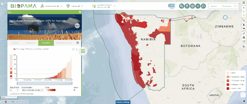
- Added the statistical Analysis tool (image below)